Subscribe To Newsletter
Subscribe to the IMSI mailing list to receive updates on product launch, special offers and our promotions.
Civil Design Suite for TurboCAD is a plug-in that enhances your TurboCAD 2018 and TurboCAD 2019 software (Deluxe, Pro or Platinum versions) with tools for road design and analysis, surveying and data collection, construction documentation, map production, storm and sanitary analysis and much more.
The Civil Design Suite for TurboCAD is a plugin to TurboCAD Deluxe, or TurboCAD Pro Platinum (2018, 2019). Add these tools to your TurboCAD software for road surface and road corridor design and analysis, grading, parcel design, map production, land surveying, water and sewer line documentation, and much more.
 Create Surfaces with Points
Import points using any of the supported CAD and Shape file types, to accurately create surfaces and solids.
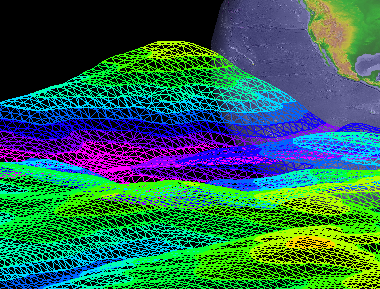
 Triangular Irregular Network (TIN) Tools
Using the Triangular Irregular Network (TIN) tools to you will be able to filter and optimize your geometry.
 Contours
Create major and minor contours with elevation data.
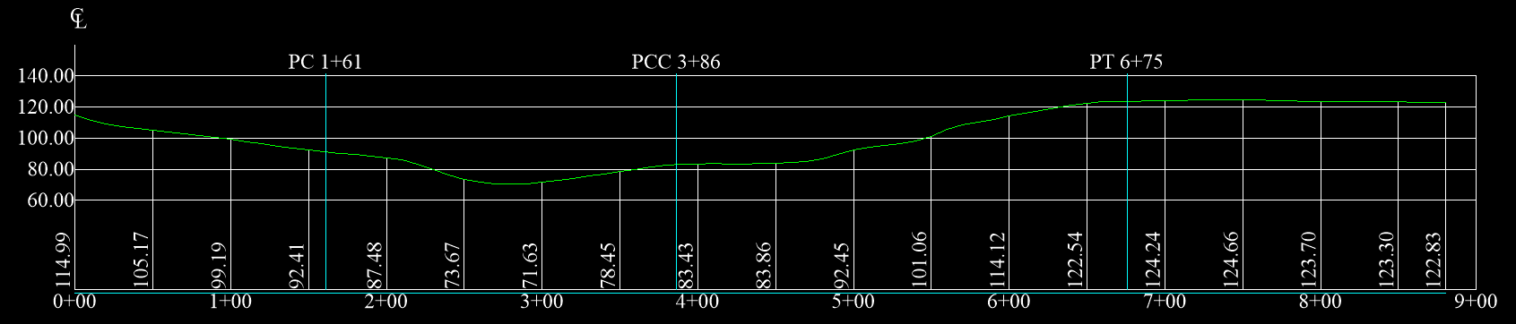
The TIN surface profile along a polyline allows users to (1) station interval distance, (2) plan view, (3) save data to the clipboard, and (4) save a simple graph to the clipboard. Click the image to enlarge and see an example of a plan view.
 Flow Lines
The Flow lines tool lets you display slope angles and direction at any desired point on your surface.
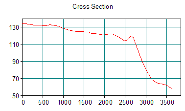 Cross Sections
Access tools to quickly create surface cross-sections.
 Image Maps
Generate an image map with colors based one elevation, aspect, or slope.
 Calculate Volume
The Side Slope tool allows users to calculate the volume between two surfaces
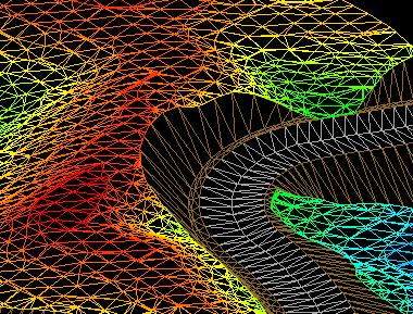 Create Roads
The Road Surface and Corridor tools allow you to create roads and road cross sections. Click image for an example. Each cross section includes: (1) Cut area, (2) Fill area, (3) Incremental cut volume, (4) Incremental fill volume, (5) Total cut volume, and (6) Total fill volume.
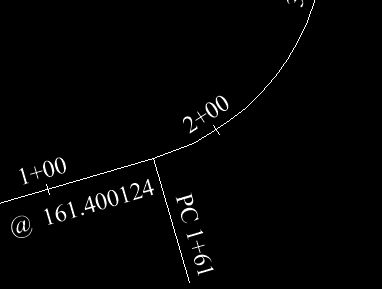 Horizontal Curve Tool
It starts by selecting a polygon. The vertices of the polygon are assumed to be the PIs (point of intersections) of the road to be designed or the water/sewer line to be documented. The tool allows you to define the curves that connect one segment between two PIs to the segment between the next PIs using a radius of the desired curve (or max available based on segment lengths). It allows you to depict the station offsets and distances with or without curves added. When curves are added their starts and ends are part of the object display and the text printout.

